Search
Webcams
Lodging
Request information

Lago del Mis

Valbelluna

Valbelluna
Lago del Mis
Lago del Mis, SP2 loc.Pian Falcina - 32037 Sospirolo (BL) IT +39 0039 348 4152619 patriziodb@libero.it ristoropianfalcina.it/

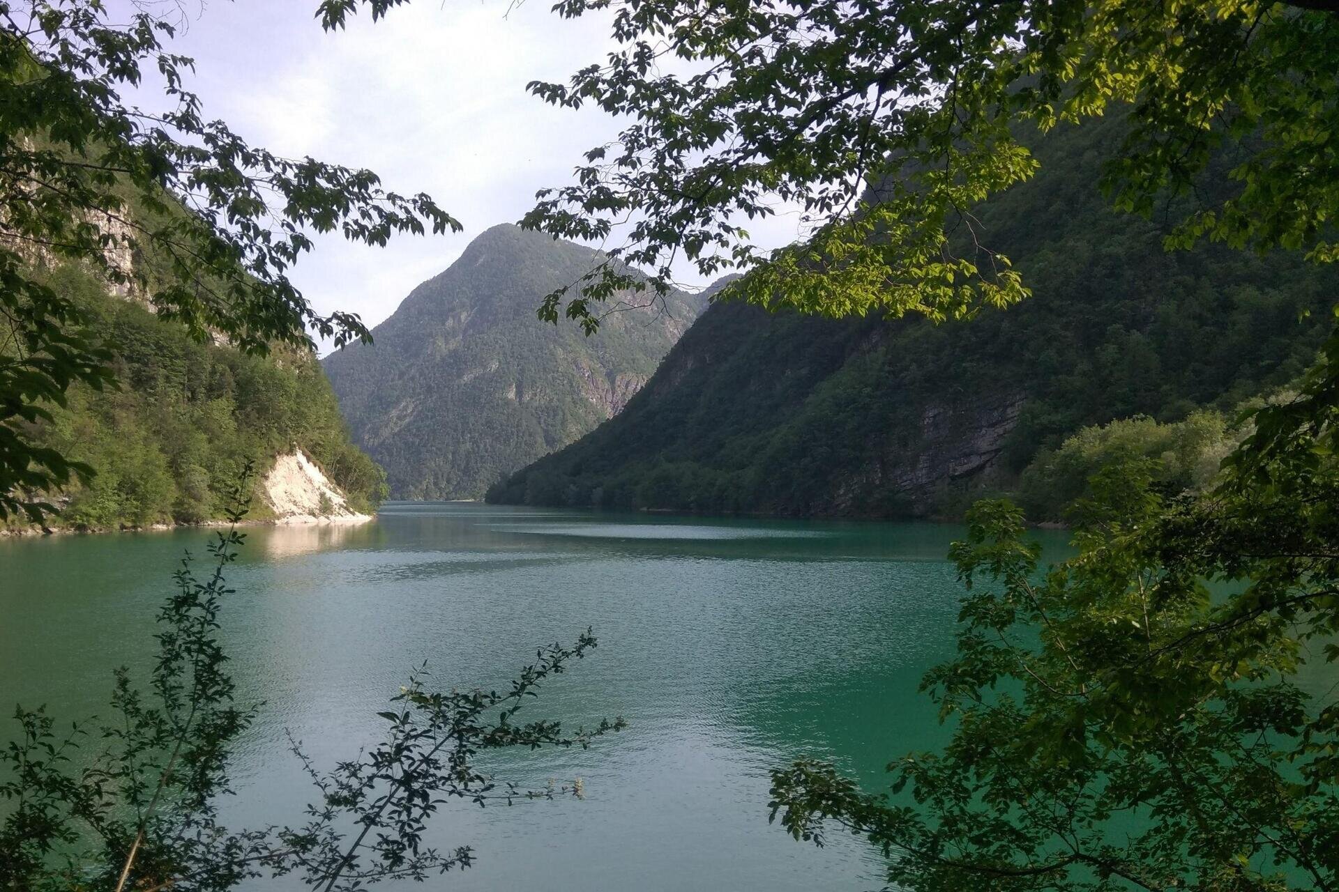
The basin was created in 1962 after the construction of the dam of the same name near the village of Pascoli di Sospirolo (BL). The dam is a double-curvature dome that rests on a pedestal that extends along both banks and the cushion.

The construction of the basin led to the flooding of a large part of the valley floor of the Mis Canal, resulting in the expropriation of land and buildings from hundreds of inhabitants, who were therefore forced to evacuate. The waters of the basin submerged and destroyed several villages, including Gena Bassa, of which only the church has been rebuilt, now on the shores of the basin.

Numerous trails develop around the lake, the beautiful La Soffia waterfall, the Cadini del Brenton, and some resting and refreshment points, as well as equipped areas for campers and barbecues.

The lake is now included in the national park of the Belluno Dolomites, a characteristic that makes it a popular bathing destination.


In 2020, Lake Mis obtained the certification of “five blue flags” for Italian lake resorts from Lega Ambiente and Touring Club.


A large transverse valley
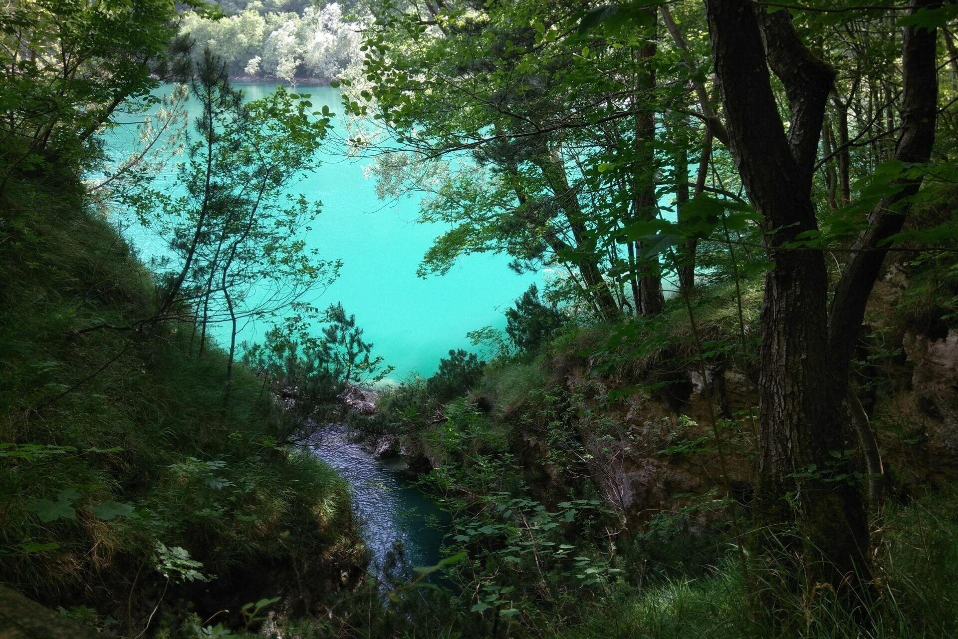
The Val del Mis, a narrow and deep canyon confined within high, polished, and elusive walls, is a very ancient transverse valley that cuts (transversely) through the entire range of the Belluno Dolomites, thus allowing observation of the main geological formations, from the Red Scaglia (the mouth of the valley) to the Main Dolomite.

Val del Mis, as is often the case with ancient valleys, is a complex environmental system, whose morphologic evolution has been shaped by valley glaciers, watercourses, slope degradation processes (landslides and erosion), and karst corrosion. The glacial shaping, executed by the ancient valley glacier of Mis during the Ice Age, is recognizable by the gently U-shaped profile (relatively wide valley floor and steep, often rocky sides). The gorge is flanked by a system of narrow/deep side valleys and gorges, some of which are clearly aligned along significant faults (Val Falcina, Val Brenton, Val Soffia). With brief detours from the provincial road, it is possible to venture into and explore very suggestive and interesting microenvironments.

Lago del Mis
Acque turchesi del Mis

Price Info

Il bacino è stato creato nel 1962 dopo la costruzione dell'omonima diga all'altezza dell'abitato di Pascoli di Sospirolo (BL). Lo sbarramento è a cupola a doppia curvatura e appoggia su un pulvino che si sviluppa lungo le due sponde e sul tampone.

La costruzione del bacino ha portato alla sommersione di buona parte del fondovalle del Canale del Mis con l'esproprio di terreni e fabbricati di centinaia di abitanti, costretti quindi allo sgombero. Le acque del bacino hanno sommerso e distrutto alcuni villaggi tra cui Gena Bassa, di cui è stata ricostruita solo la chiesa, oggi sulle rive del bacino.

intorno al lago si sviluppano numerosi sentieri, la bella cascata de La Soffia, i Cadini del Brenton e alcuni punti d'appoggio e di ristoro, nonchè aree attrezzate per camper e grigliate.

Il lago è oggi compreso nel parco nazionale delle Dolomiti Bellunesi, caratteristica che lo rende il una meta balneare frequentata.


Nel 2020 il Lago del Mis ha ottenuto la certificazione di “cinque bandiere blu” per le località lacustri italiane da parte di Lega Ambiente e del Touring Club.


Una grande valle trasversale
La Val del Mis, stretto e profondo canyon confinato entro alte pareti levigate e sfuggenti, è una valle trasversale molto antica, che solca (trasversalmente) l’intera catena delle Dolomiti Bellunesi, consentendo così di osservare le principali formazioni geologiche, dalla Scaglia rossa (imbocco della valle) alla Dolomia Principale.

La Val del Mis, come spesso succede per le valli antiche, è un sistema ambientale complesso, alla cui evoluzione morfologica hanno concorso i ghiacciai vallivi, i corsi d’acqua, i processi di degradazione dei versanti (frane ed erosioni) e la corrosione carsica. Il modellamento glaciale, operato dall’antico ghiacciaio vallivo del Mis durante l’era glaciale, è riconoscibile per la forma blandamente a U del profilo trasversale (fondovalle relativamente ampio e fianchi ripidi, spesso rupestri). La gola è fiancheggiata da un sistema di vallette laterali strette/profonde e di forre, alcune delle quali chiaramente impostate lungo importanti faglie (Val Falcina, Val Brenton, Val Soffia). Con brevi digressioni dalla strada provinciale è possibile addentrarsi ed esplorare microambienti molto suggestivi e interessanti.

Stay in touch

Sign up for the Dolomites in Belluno newsletter!
You will receive news, information, itineraries, ideas and tips for your vacation throughout the year.

Thank you

Grazie: ti abbiamo inviato una mail per attivare la tua iscrizione e selezionare le tue preferenze se previsto.

Something went wrong

Retry

Close

Subscribe to the newsletter


(You can choose more than one)

Cancel
Close

Thank you

Your request has been sent successfully and we will reply as soon as possible. A copy of the data you have provided us with has been sent to your email address.

Close

Request information

You are sending the request to: Belluno Dolomites


Close